Caring for the Land after Catastrophe
In the wake of Helene, Southern Appalachian Highlands Conservancy’s land stewardship team perseveres with new intensity. We continue to meet land management responsibilities while tenaciously facing obstacles and meeting evolving challenges. Over the past months, SAHC’s “stew crew” has tackled technology improvements to enhance monitoring, assessed damage on preserves, repaired access points, and navigated partnerships to accomplish environmental recovery goals across the landscape. We continue to assess damage, plan recovery efforts, and explore ways to adapt land management.
Monitoring Protected Land
As a leader in the conservation field, SAHC began developing procedures to use remote monitoring several years ago. Stewardship Director Sarah Sheeran has led professional workshops about implementing remote monitoring for conservation properties. After Helene, SAHC’s cutting-edge stewardship capabilities helped ensure we were able to successfully complete 2024 monitoring responsibilities and positioned the team to better meet additional challenges due to storm damage.
“All the properties in our stewardship portfolio – the land SAHC owns and conservation easements we hold – must be monitored at least once per year,” explains Sarah. “Because we had a remote monitoring program in place since late 2019, we were able to quickly and seamlessly shift our remaining monitoring burden in 2024 entirely to remote monitoring.”
Helene damage presented the team with challenges related to accessibility, safety, and efficiency.
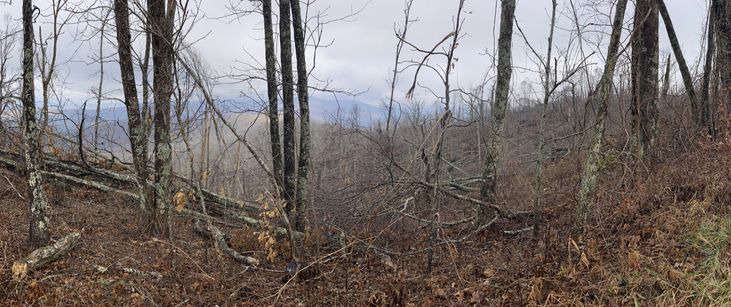
“Many conservation properties were (and some remain) inaccessible due to damages to roads, culverts, bridges,” explains Sarah. “Many properties also suffered substantial tree blowdown and have unstable slopes associated with landslides, making it difficult and unsafe to traverse the property on foot. We lost over a month of monitoring time, and using remotely sensed data allowed us to ‘see’ more properties in a short period of time, which also allowed us to spend more time communicating with our conservation easement landowners and other community members.”
To meet challenges in monitoring and land management, the stewardship team relies on high resolution satellite imagery provided by a subscription service, aerial footage from drones piloted by SAHC staff, and remote disturbance/change mapping.
“True color imagery can show obvious and substantial changes to the landscape like debris flows and landslides,” continues Sarah. “If resolution is high enough, we can even see individual downed trees. Roan Technician Travis Bordley has been instrumental in capturing aerial images of properties that were inaccessible on the ground. He identified significant landslides, debris flows, and blowdowns, particularly in sensitive habitats like spruce-fir forests. His work and funding provided by The Community Foundation of Western North Carolina have been critical in our decision to purchase unmanned aerial vehicles and certify additional staff pilots, because areas of our conserved properties will remain inaccessible or unsafe for years to come. Remote monitoring does not entirely replace on-the-ground work, but it provides us with a tool to better prepare for site visits by showing us which areas might be difficult to access.”
Remotely sensed vegetation data can help identify significant disturbances to vegetation vigor, and HiForm (High-resolution forestry mapping) data provided by the U.S. Forest Service can help the team determine impacts to conserved properties in order to assist in assessment and recovery. Using various data sets helps the team more effectively plan and implement land management efforts.
Partnerships
SAHC has teamed up with partners such as the NC Wildlife Resources Commission (NCWRC) and National Parks Conservation Association NPCA) to facilitate comprehensive data collection.
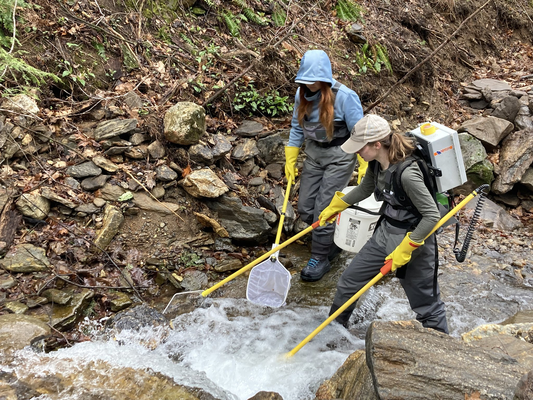
“This cooperation and data sharing provide a great example of partnership work with other agencies during recovery efforts,” says Sarah. “For example, by allowing NCWRC staff to access streams on SAHC preserves and survey trout populations, we help them fill gaps in data, and they in turn share findings with us to assist with managing the land in recovery.”
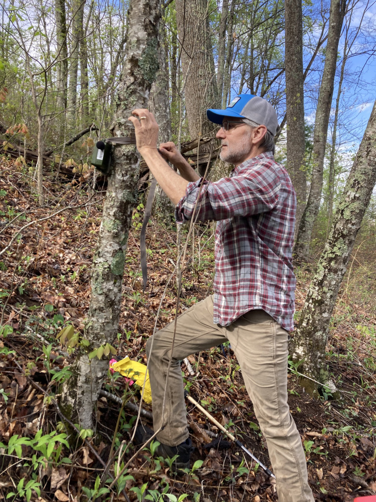
SAHC hosted a Lunch and Learn with guest speaker Steve Goodman (recording available via YouTube/@sahc) to highlight how NPCA has collaborated with SAHC on bird diversity research using bioacoustic monitoring, followed by a guided hike to our Stevens Creek preserve in the Smoky Mountains to demonstrate the use of autonomous recording units (ARUs). Steve also accompanied the stewardship team on site visits in the Black and Craggy Mountains.
“SAHC is helping NCPA (in partnership w/NCWRC) facilitate access to public lands by way of SAHC-protected properties since traditional access points are closed due to storm damage,” adds Sarah. “This work is tied to Steve’s avian diversity project, which he presented in the Lunch & Learn. Steve and other researchers are looking at population declines in birds, and exploring whether populations were impacted by the Helene.”
Grants Support Recovery
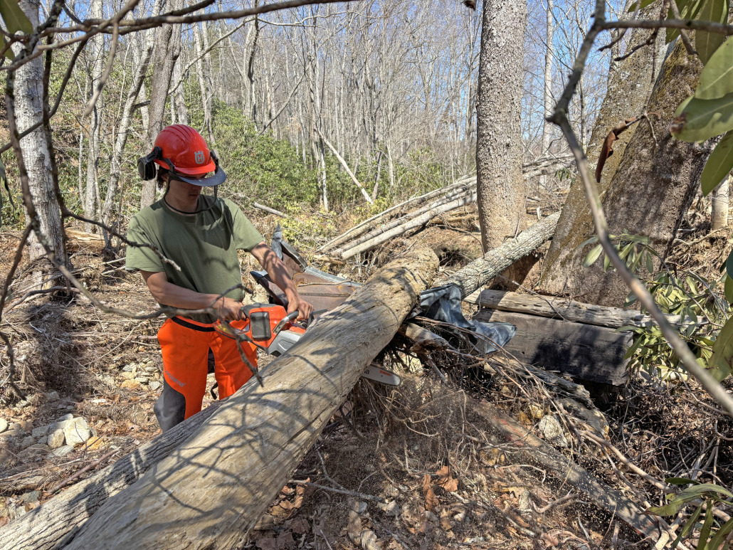
SAHC extends deep gratitude to The Community Foundation of Western North Carolina (CFWNC) for providing Emergency and Disaster Response Fund grant support to assist recovery efforts on conserved land. CFWNC’s grant support is helping SAHC provide personal protective equipment for volunteers and staff conducting recovery work, purchase saws to remove downed trees, repair roads and bridges to restore access to conservation land, and much more.
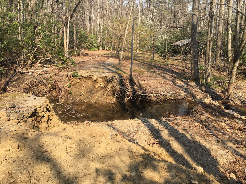
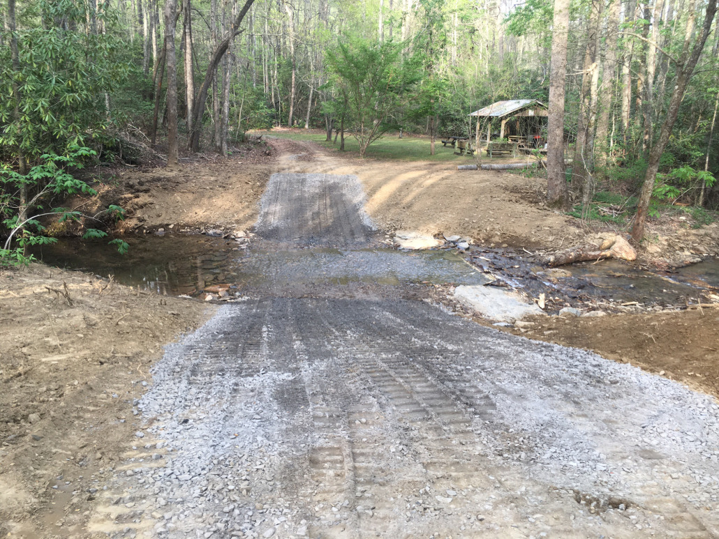
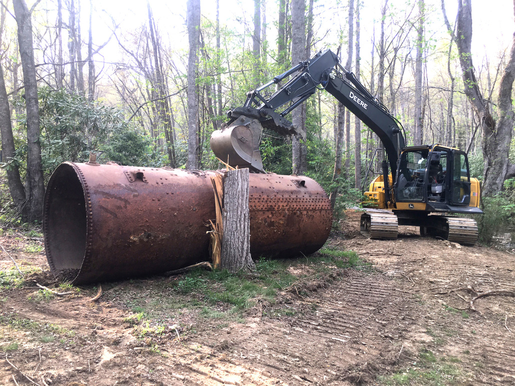
We are also very grateful to the NC Land and Water Fund for providing funding support to SAHC for emergency management, and to the Lampton Family Foundation for supporting the culvert replacement and stream repair on our preserve on the upper Catawba headwaters. The stream crossing to access this SAHC-owned preserve, protected by former landowners Mary and Joe Hemphill, suffered catastrophic damage during Helene. A very large iron boiler, which had been installed by previous landowners as a culvert, washed downstream. We repaired the stream bank and replaced the culvert with an improved crossing.
Thank you so much for your support!