
Rough Creek Watershed

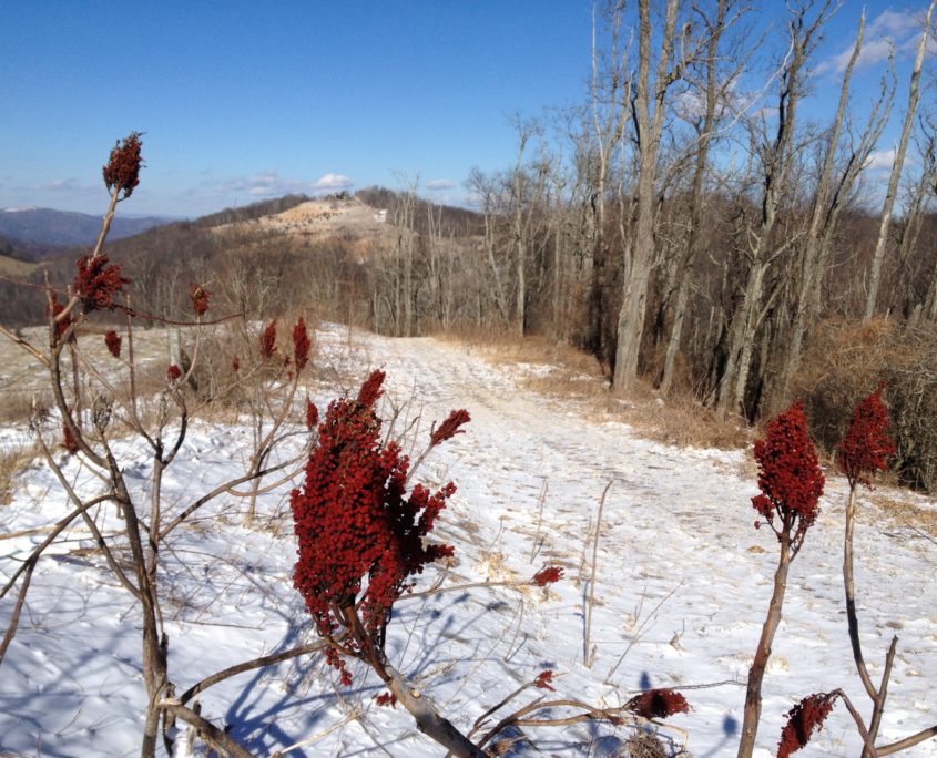
Project Highlights
SAHC was instrumental in the protection of this 873-acre conservation easement held by the NC Clean Water Fund (formerly NC Clean Water Management Trust Fund), co-managed with SAHC and owned by the Town of Canton. Our Stewardship Team monitors the conservation easement each year, to ensure that the land and water resources will continue to be protected for future generations.
SAHC Focus Area: The Rough Creek/Canton Watershed conservation project is located within SAHC’s French Broad River Valley Conservation Focus Area.
The property was once used as a water resource for the Town of Canton. It contains nearly 7 miles of streams, numerous seeps, springs, & swamp/bog areas which have become fairly uncommon with human inhabitants of the region.
The watershed contains many species of interesting & rare plants (painted trillium, whorled pogonia) as well as a large & diverse animal population (salamanders, turkey, bear, bobcats, songbirds). This diversity provides the residents of Haywood County, and particularly the Town of Canton, an opportunity to experience in their own backyard biodiversity similar to that found in the Great Smoky Mountain National Park.
The water found in Rough Creek Watershed is classified by the State of North Carolina as an outstanding water resource. The purity of the water rivals and often exceeds comparison to other protected waters in the state.
Did You Know? Just over the ridge, SAHC has been working to preserve an assemblage of land around Beaverdam Creek in a series of contiguous projects since 2015. Some of these tracts directly adjoin the Rough Creek Watershed, including a 139-acre tract purchased in 2019 and a 54-acre addition purchased in 2020. In 2023, SAHC added another 78 acres of protected land to this connected conservation area.
To read more about this property visit the Town of Canton’s website here.


How to Visit
Trail Info
Miles: The Rough Creek Watershed Trail System comprises 3 trails of various distances, totaling 10+ miles.
Style: Out and Back
Elevation gain: 1443 ft.
Difficulty: steep to moderate, good climb in the beginning and then moderate, relatively low grade
Rough Creek Watershed Map
Click link for PDF copy of trail map.
Getting There
Location/How to get there: From Asheville, take I-40 West to exit 33 and continue straight on Freedom Drive. At the junction, turn right on Beaverdam Road and in roughly two miles, left on Rice Cove Road. At the “T,” go right on Rough Water Road. In a quarter mile at the end of two-lane pavement, go left through the closed gate and cattle guard (please close gate back) and continue uphill to the parking area, which is to the left of the trailhead kiosk.
Access Info: As noted above, the driveway into the watershed is gated at the bottom, you will have to open and close the gate when you enter/exit. Please note that the road goes through private property and leaving the roadbed is PROHIBITED.
From the parking area at the trail kiosk below the caretaker’s house, access the trail system on foot, by following the soil roadbed to the left of the parking area (not the driveway to the caretaker house) to the gated entrance of the watershed.
Close the gate and continue up the road to a signed intersection. At the intersection, go either left or right and follow the signs to the lower trailhead for Cherry Cove Trail. On Cherry Cove Trail, follow the trail signs to the West Boundary Road. Go right on the road and rejoin Cherry Cove Trail where it goes back into the woods (a right turn). Cherry Cove Trail will end at the East Boundary Road. To return to the parking area, either backtrack on Cherry Cove Trail or turn right and follow the signs back to the entrance road. (see trail map for more information)
More Info
Direct connection to the Town of Canton’s page on Rough Creek Watershed.

Conservation Story
The Rough Creek Watershed property consists of over 870 acres of beautiful & majestic land, owned by the Town of Canton. This property is located on the south side of the Newfound Mountain Range, approximately 5 miles north of the Town of Canton in Western North Carolina. The Rough Creek Watershed Trail System is comprised of 3 trails of various distances, totaling 10+ miles. This immense natural resource is open to the public for hiking and mountain biking year round!
Partnerships for Conservation!
In 2002, a partnership was created between SAHC, the Town of Canton, and the North Carolina Clean Water Management Trust Fund (now known as the NC Clean Water Fund). This relationship led to the establishment of a conservation easement throughout the Rough Creek property, ensuring the permanent protection of its unique forest ecosystem and natural resources.
Related Stories



We Can't Do It Without You
Together, we can protect Appalachia’s lands and secure a healthier future for generations to come.